GeoLibre vs. other GIS platforms
How GeoLibre compares to the desktop GIS, cloud GIS, and web-mapping tools people most often ask about: QGIS, ArcGIS Pro, ArcGIS Online, CARTO, Felt, and kepler.gl — plus Google Earth and Google Earth Pro, which get a section of their own because they are virtual globes rather than a GIS.
GeoLibre is not trying to replace any of these outright. It occupies a spot none of them quite fills: a free and open-source GIS that runs in a browser tab with nothing installed, keeps your data on your own machine, and still ships real analysis, spatial SQL, cartography, and a project file — then packages the same app as a desktop install, an Android app, an iOS app, and a Jupyter widget.
How to read this
Comparisons like this age quickly and are written by an interested party. The GeoLibre column reflects what ships today; the other columns describe each product's mainstream, out-of-the-box behavior as of August 2026, not what is reachable with every add-on, extension, or third-party plugin. Where a capability arrives through a separate product (QField for QGIS in the field, ArcGIS Field Maps for ArcGIS), the table says so rather than crediting it to the base product. Found something wrong or out of date? Please open an issue — corrections are welcome.
This page is closed to new columns
The comparison matrix below covers a fixed set of platforms and is not accepting additional ones. Every extra column means more than forty cells that have to be researched, dated, and re-verified on each update, and the tables have reached the width a page can readably hold. Adding more would make the comparison harder to read and harder to keep honest.
Google Earth sits in its own section with a short table of its own, because it is a viewer rather than a GIS and most of the matrix rows would simply read "—" for it. That is a one-off, not an opening.
Corrections to the platforms already listed are still very welcome. If you maintain another tool and want it compared with GeoLibre, publish that comparison on your own site and add a link under Comparisons hosted elsewhere.
Complementary, not competing
A useful way to think about GeoLibre and QGIS is smartphone cameras versus professional cameras. Smartphone cameras did not replace professional cameras, and it would not have made sense to pour every advance in photography into making professional cameras better. The two serve different people and different moments. A professional camera offers tremendous power, flexibility, and control. A smartphone camera prioritizes accessibility, convenience, and the ability to capture and share something instantly.
QGIS is the professional camera: mature, powerful, feature-rich, and extensible. GeoLibre is closer to the smartphone camera: lightweight, reachable from a web browser, cross-platform, and designed so that people can work with geospatial data without installing complex software or setting up servers.
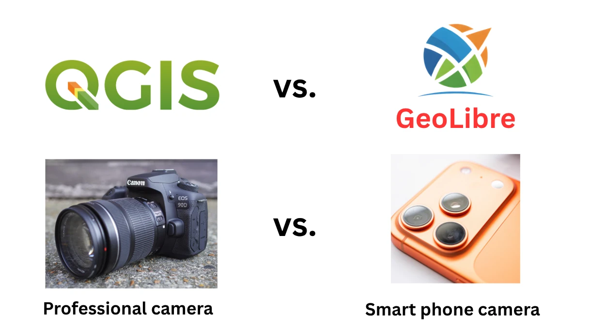
The geospatial community benefits from both. Separate projects can also experiment with new architectures and technologies, and the ideas that work out can strengthen the broader open-source geospatial ecosystem. The goal of GeoLibre is not to replace QGIS, but to make GIS accessible in places, and to people, where a traditional desktop GIS may not be the best fit.
The rest of this page is written in that spirit: the tables are there to help you pick the right tool for a given job, not to declare a winner.
At a glance
| GeoLibre | QGIS | ArcGIS Pro | ArcGIS Online | CARTO | Felt | kepler.gl | |
|---|---|---|---|---|---|---|---|
| License | MIT, open source | GPL-2.0+, open source | Proprietary | Proprietary | Proprietary | Proprietary | MIT, open source |
| Cost | Free | Free | Paid subscription | Paid subscription (credit-metered analysis) | Paid subscription | Paid subscription | Free |
| Browser | Full app, nothing to install | No official browser build | No | Yes (the product is the browser app) | Yes | Yes (the authoring product) | Yes |
| Desktop | Windows, macOS, Linux (Tauri) | Windows, macOS, Linux | Windows only | — | — | — | — |
| Mobile | Native Android and iOS apps; responsive touch layout | Via QField / Mergin Maps (separate apps) | — | Via ArcGIS Field Maps (separate app) | — | Felt Field App for iOS and Android (separate app) | Responsive web |
| In Jupyter | Full app as an anywidget, two-way sync | Via qgis bindings, not the UI |
Notebooks drive arcpy, not the UI |
ArcGIS API for Python | Via pydeck-carto |
— | Yes (widget) |
| Works offline | Yes — PWA install, offline area download, desktop build | Yes | Yes | Limited (Field Maps offline areas) | No — connected platform by design | Field App offline areas, syncing on reconnect (higher plans) | Client-side, but assets are hosted |
| Where your data lives | Your device — processed client-side in the browser session | Your device | Your device / your enterprise geodatabase | Vendor cloud | Your own cloud data warehouse — no CARTO-side storage (except cache) or sync; imports write to a warehouse you own | Vendor cloud, or a single-tenant instance in your own AWS account (Enterprise) | Your browser |
| Project file | .geolibre / .geolibre.json (open, documented) |
.qgs / .qgz (open) |
.aprx (proprietary) |
Web map JSON (hosted) | Map/Workflow JSON via CLI and MCP | Hosted map (no local file) | Exportable map config JSON |
Data and formats
| GeoLibre | QGIS | ArcGIS Pro | ArcGIS Online | CARTO | Felt | kepler.gl | |
|---|---|---|---|---|---|---|---|
| Format breadth | Wide — DuckDB-WASM Spatial plus in-house readers | Widest — everything GDAL/OGR reads | Very wide, plus native Esri formats | Common upload formats | Common upload formats + RaQuet for raster data | Common upload formats | CSV, GeoJSON, Arrow/Parquet |
| Cloud-native vector | GeoParquet, FlatGeobuf, PMTiles, streamed over HTTP range requests | GeoParquet, FlatGeobuf, PMTiles (recent GDAL) | GeoParquet (recent), no native PMTiles | — | GeoParquet | Some cloud sources on higher plans | Arrow/Parquet |
| Cloud-native raster | COG, Zarr, Cloud-Optimized NetCDF/HDF, kerchunk, MBTiles | COG, Zarr (GDAL's built-in driver) | COG; Zarr as a native multidimensional raster type | Hosted imagery layers | COG and GeoTIFF, loaded into warehouse tables (RaQuet spec) | GeoTIFF upload | — |
| STAC | Built-in catalog browser + STAC Index discovery | Built-in STAC connections (Browser panel and Data Source Manager) | Built-in STAC connections and the Explore STAC pane | Living Atlas (not STAC) | — | — | — |
| OGC services | XYZ; WMS/WFS/WMTS discovered via GetCapabilities; OGC API Features/Tiles from a landing page, collection, or items URL | Full OGC support | Full OGC support | Yes | Limited | Limited | XYZ / vector tiles |
| Esri services and geodatabases | ArcGIS FeatureServer, VectorTileServer, I3S, plus local .gdb File Geodatabase folders (desktop) |
Yes | Native | Hosted feature, tile, imagery, and scene layers | One-way ArcGIS Online / Portal migration tooling only | Some ArcGIS layers | — |
| Databases | PostGIS browsing, DuckDB, in-browser PGlite/PostGIS | PostGIS, SpatiaLite, Oracle, SQL Server, SAP HANA | Enterprise geodatabases (SDE) | Hosted only | The core product — BigQuery, Snowflake, Redshift, Databricks, PostgreSQL/PostGIS, Oracle Spatial, all queried live | PostGIS / Snowflake connections (higher plans) | — |
| 3D and point clouds | LiDAR, 3D Tiles, I3S, Gaussian splats, glTF/GLB, Cesium globe pane | Point clouds, 3D map view, tiled scene layers | Deepest 3D — scenes, I3S, mesh, LAS | Scene Viewer | 3D map view, extrusion, Google Photorealistic 3D Tiles basemap. No point clouds or LiDAR | — | Extrusions and hexbins only |
| Planetary basemaps | Moon, Mars, Mercury, Venus, Galilean moons, Titan, Pluto, Charon — with a per-project ellipsoid driving measurements | Via plugins | Limited | — | — | — | — |
Analysis and processing
| GeoLibre | QGIS | ArcGIS Pro | ArcGIS Online | CARTO | Felt | kepler.gl | |
|---|---|---|---|---|---|---|---|
| Geoprocessing tools | 1,000+ (Whitebox suite + GeoLibre's own), running in the browser on WebAssembly | 1,000+ (native, GDAL, GRASS, SAGA) | Most mature and complete, plus paid extensions | A useful subset, credit-metered | 200+ Workflows components and 180+ Analytics Toolbox SQL functions, executed as SQL in your warehouse | A small set of common tools | No tool catalog — analysis goes through SQL and the AI assistant |
| Where analysis runs | Your browser (WASM), no server required; optional Python sidecar on desktop | Your machine | Your machine, or a server/portal | Vendor cloud | Your cloud data warehouse — queries are pushed down live, with repeated identical queries served from CARTO-managed cache | Vendor cloud | Your browser |
| Vector analysis | Buffer, overlay, dissolve, joins, selection, topology checks — Turf.js, or GeoPandas via Pyodide/sidecar | Comprehensive | Comprehensive | Common tools | Buffer, overlay, spatial join, clip, Voronoi/Delaunay, KNN, trade areas — as warehouse SQL | Common tools | Spatial joins via SQL or the AI assistant |
| Raster analysis | Hillshade, slope, contour, zonal/focal stats, raster calculator, reclassify, mosaic — rasterio sidecar with a browser fallback | Comprehensive (GDAL/GRASS/SAGA) | Comprehensive; Spatial Analyst extension | Limited | Narrow — zonal statistics and band value extraction | — | — |
| Spatial SQL | DuckDB Spatial, PGlite/PostGIS, and Apache Sedona — all in the browser | Virtual layers, DB Manager, PostGIS connections | SQL against enterprise geodatabases | — | The native interface — warehouse SQL everywhere: query sources, SQL parameters, Workflows, SQL API | SQL on connected sources (higher plans) | DuckDB SQL Data Explorer over loaded data and remote URLs |
| Model / batch chaining | Batch runner with model and pipeline chaining | Graphical Model Designer | ModelBuilder | — | Workflows — visual DAG builder with scheduling, version history, and SQL export | — | — |
| Spatial statistics | Toolbox including Emerging Hot Spot Analysis | Via plugins and processing providers | Full Spatial Statistics toolbox | Some | Deep — Getis-Ord, Moran's I, space-time hotspots, GWR, kriging/IDW, composite scores, twin areas | — | — |
| Network analysis | Isochrones, service areas, OD cost matrices, routing | QGIS Network Analysis, plugins (ORS, pgRouting) | Network Analyst extension | Routing services (credits) | Isolines, routes, and routing matrices via Location Data Services (credit-metered) | — | — |
| AI / ML | AI Segmentation (SamGeo/SAM 3), in-browser ONNX/YOLO object detection | Via plugins | arcgis.learn deep-learning toolset |
Pretrained models (credits) | BigQuery ML and Snowflake ML components; embeddings and geospatial foundation models | — | — |
| Processing history | Every run listed, re-runnable, with copyable Python | History panel | Geoprocessing history | — | Workflow version history and run logs; org-wide activity/audit log (Enterprise) | — | — |
Cartography, styling, and layout
| GeoLibre | QGIS | ArcGIS Pro | ArcGIS Online | CARTO | Felt | kepler.gl | |
|---|---|---|---|---|---|---|---|
| Renderers | Single, categorized, graduated, rule-based, expression, heatmap, cluster, proportional symbols, diagrams | Richest — plus every symbol layer type | Very rich | Smart-mapping styles | Point, line, polygon, grid, H3, raster — plus heatmap and cluster aggregation; quantile/quantize/log/custom scales | Simple, well-designed defaults | Visualization-oriented |
| Data-defined everything | Expression Builder wired into filters, labels, styling, field calculation, selection | Yes, pervasive | Attribute-driven symbology (Arcade) | Arcade | Attribute-driven styling per channel; custom SQL aggregation expressions in place of an expression language | — | — |
| Labeling | Data-defined engine with placement, offset, rotation, wrap, dedup | Best-in-class placement engine | Maplex label engine | Basic | Basic | Basic | Basic |
| Print layout | Print Layout composer with legend, scale, title block, atlas / map series, PNG and PDF | Full print composer with atlas | Full layout view with map series | Basic print / export | Export to high-res image and PDF | Export to image and PDF | Image export |
| Style interchange | Imports and exports OGC SLD, QGIS QML, and Mapbox GL JSON | QML, SLD | .lyrx, limited SLD |
— | — | — | — |
| Project import | Reads QGIS .qgs/.qgz and ArcGIS Pro .aprx/.mapx |
Reads its own | Reads its own (and .mxd) |
— | — | — | — |
| Story maps | Built-in story map builder with presenter view and standalone HTML export | Via plugins | — | ArcGIS StoryMaps (separate product) | Built-in skill for storymaps app development | Shareable maps, not chaptered stories | — |
| Dashboards | Dashboard panel of chart and indicator widgets with cross-filtering | Via plugins | — | ArcGIS Dashboards (separate product) | Core to CARTO Builder — formula, category, pie, histogram, range, time series, and table widgets with cross-filtering | Dashboard components — statistics, bar, histogram, time series | Charts and filters in-map |
Automation, extensibility, and sharing
| GeoLibre | QGIS | ArcGIS Pro | ArcGIS Online | CARTO | Felt | kepler.gl | |
|---|---|---|---|---|---|---|---|
| Scripting | Python Console, geolibre Python package, docked Jupyter notebook beside the map |
PyQGIS, qgis_process headless CLI |
arcpy, notebooks |
ArcGIS API for Python / JavaScript | CARTO + deck.gl + CARTO CLI + REST APIs | REST API + Python client | JS library |
| Notebook integration | The whole app embeds as a Jupyter anywidget with two-way project sync | Bindings, not the UI | Notebooks in Pro drive arcpy |
Hosted notebooks | pydeck-carto widget in Jupyter or Colab; Analytics Toolbox SQL from any warehouse notebook |
— | Widget |
| Plugin ecosystem | TypeScript plugin API, built-ins, zip installs, bundled drop-ins | Largest — thousands of Python plugins | .NET add-ins, Python toolboxes | Configurable app templates | Workflows extension packages | None (API only) | Fork the library |
| AI assistant | Natural-language assistant that turns plain English into auditable, undoable operations; bring your own API key | Via plugins | Copilot features | Arcade assistant (beta) and the AI assistants family | AI Agents on a map — semantic model, configurable tools, bring your own LLM — plus a hosted MCP server, CLI, and agent skills | AI-assisted map making | Yes — OpenAI, Gemini, DeepSeek, or local Ollama; bring your own key |
| Real-time collaboration | Yes (MVP) — hosted relay, optionally self-hosted — plus anchored review comments | No (Mergin Maps for sync) | No | Shared editing of hosted layers | Asynchronous plus real-time map-anchored comments | Best-in-class multiplayer editing and comments | — |
| Embedding | maponly and layout=viewer URL modes, a versioned postMessage API, and the typed @geolibre/embed npm client |
QGIS Server / QGIS2Web export | — | Embeddable web apps | Embeddable private maps with URL parameters and a postMessage API |
Embeddable maps | Embeddable |
| Self-hosting | Docker image, or serve the static build anywhere | QGIS Server | ArcGIS Enterprise (paid) | — | Yes — Docker on a single VM or Kubernetes, on any vendor cloud or on-premises | Single-tenant AWS VPC, Felt-maintained (Enterprise) | Static build |
| Standalone export | Whole project to one offline HTML file, no server | Via qgis2web plugin | — | — | Data export to CSV, GeoJSON, GeoPackage, GeoParquet, KML, and Shapefile | — | HTML export |
Google Earth and Google Earth Pro
Google Earth is the tool most people have used before they ever open a GIS, and it is the comparison this project is asked about most often. It belongs in a different category than everything above: Google Earth is a virtual globe for exploring, annotating, and presenting Google's imagery, while GeoLibre is a GIS that happens to ship a globe. The two overlap at the moment of looking at the Earth and diverge almost everywhere after it.
Two products share the name, and they are heading in opposite directions:
- Google Earth (the web app, plus the Android and iOS apps) is the one Google is investing in. It comes in three plans: Standard is free, while Professional and Professional Advanced are paid per seat. Standard covers exploring, drawing, measuring, historical imagery, Street View, and broadly applicable data layers such as administrative areas, postal codes, and household income, with projects stored in Google Drive and shared like any other Drive file. The paid plans add specialized layers (finer elevation contours, slope and aspect, inundation history, parcel zoning, traffic), larger design quotas and cloud import storage, and more of the Gemini-powered Ask Google Earth, which every plan includes at a limited, higher, or highest level of access.
- Google Earth Pro (desktop, version 7.3.x) is the free application GIS users have leaned on for historical imagery, Shapefile and GeoTIFF import, viewshed, elevation profiles, and HD movie export. Google has announced that desktop downloads end on 25 June 2027, and that existing installations keep working after that date. A workflow that depends on being able to install Earth Pro on new machines is worth planning around now.
Google Earth Engine is a third, unrelated product — a cloud platform for planetary-scale raster analysis — and is out of scope here.
| GeoLibre | Google Earth (web and mobile) | Google Earth Pro (desktop) | |
|---|---|---|---|
| License and cost | MIT, free | Proprietary; free tier plus paid per-seat plans | Proprietary, free — downloads end 25 June 2027 |
| What it is for | Analysis, cartography, and data work | Exploring, annotating, and presenting imagery | The same, with a GIS-adjacent import and measurement set |
| Runs on | Browser, Windows, macOS, Linux, Android, iOS, Jupyter | Browser, Android, iOS | Windows, macOS, Linux |
| Where your data lives | Your device, processed client-side | Your Google account and Drive | Your device |
| Data in | Vector, raster, tiles, databases, STAC, OGC and Esri services, and cloud-native formats (COG, GeoParquet, PMTiles, Zarr) | KML/KMZ, GeoJSON, and zipped Shapefile into projects, plus experimental GLB-only 3D model import on the web; more import storage on paid plans | KML/KMZ, Shapefile, GeoTIFF and image overlays, CSV with address geocoding, GPS/GPX, MapInfo TAB |
| Attribute data | Attribute table, joins, field calculator, quick filters, spatial SQL | Placemark descriptions | Basic attribute display for imported files |
| Projections | Reprojects on import, searchable EPSG catalog, per-project ellipsoid driving measurements | WGS84 globe only | WGS84 globe only |
| Analysis | 1,000+ geoprocessing tools, spatial SQL, spatial statistics, routing and isochrones | Measurement, elevation profiles on the web, and layer filtering | Measure, elevation profile, viewshed |
| Symbology | Data-driven single, categorized, graduated, rule-based, expression, heatmap, cluster, proportional | KML styles set by hand | KML styles set by hand, plus style templates driven by a data column |
| Historical imagery | Historical Imagery plugin over Esri World Imagery snapshots, plus Timelapse annual basemaps | A timeline of the capture dates available for a place, plus historical Street View on the web | Historical imagery slider |
| Photorealistic 3D and Street View | Google Photorealistic 3D Tiles and Street View with your own API key; plus 3D Tiles, I3S, LiDAR, COPC, and Gaussian splats | Native, no key, best-in-class | 3D buildings and Street View |
| Presentation output | Story maps, print layout with atlas, camera tour recorded to video, dashboards, one-file offline HTML export | Shareable Drive projects with a slide-style present mode | Movie Maker HD video and high-resolution image export |
| Project file | .geolibre.json — open, documented, diffable, local |
Hosted project in Drive; KML export | .kmz / .kml |
| Automation | Python package, MCP server, Jupyter widget, TypeScript plugin API, embed API | — | — |
Where they overlap
GeoLibre borrows from the Google Earth playbook on purpose, and several features exist precisely because people expect them from Earth: a Cesium globe with terrain, an Elevation Profile along a drawn or selected line, an interactive viewshed from a right-clicked point, Historical Imagery, Street View, a camera tour recorder that exports video, and planetary globes for the Moon, Mars, and beyond.
KML fidelity gets the same treatment. GeoLibre reads KML and KMZ with an in-house
parser that preserves embedded symbology, folder structure, GroundOverlay
images, time-tagged placemarks, embedded COLLADA models, and NetworkLink
Super-Overlays served as tiles rather than loaded whole — so a document authored
in Earth Pro generally arrives looking the way it did there. That makes GeoLibre
a realistic destination for a KML archive when Earth Pro downloads end, and the
map's right-click menu still offers Open in Google Earth for trips in the
other direction.
Where Google Earth is still better
- Imagery. Google's own imagery archive, its depth of historical coverage, and the quality of its photorealistic 3D mesh are not things an open-source project reproduces. GeoLibre can display Google's photorealistic tiles with your API key, but the archive and the historical slider belong to Earth.
- Street View. Native, complete, and free of credential setup.
- Effortlessness. Earth opens and flies. There is no layer model, no CRS, no project file, and nothing to learn — for simply showing someone a place, that is exactly right.
Where GeoLibre is better
Everything downstream of looking: attribute tables and joins, a real geoprocessing toolbox, spatial SQL, data-driven cartography, print layouts, reprojection, and an open project file you can keep, diff, script, and embed. Earth shows you the world; GeoLibre lets you ask questions of your own data on top of it — and keeps that data on your machine rather than in a Google account.
Where each one is the right choice
Choose GeoLibre when you want a real GIS in a browser tab with nothing to install, your data has to stay on your machine, you work with cloud-native formats (COG, GeoParquet, PMTiles, Zarr, STAC), you want the same app on desktop, Android, and inside a notebook, or you are embedding a map workspace into your own product and want an open, documented project format and license.
Choose QGIS when you need the widest possible format support through GDAL/OGR, the deepest desktop cartography and label placement, a mature plugin for a niche task, or heavy local processing over datasets larger than a browser can hold.
Choose ArcGIS Pro when you are already in the Esri ecosystem, need enterprise geodatabase editing and versioning, the deepest 3D and imagery workflows, or a specific specialized toolbox with organizational support behind it.
Choose ArcGIS Online when the priority is hosted layers, organizational sharing and permissions, and the surrounding Esri app family (Dashboards, StoryMaps, Field Maps, Experience Builder).
Choose CARTO when your data already lives in a cloud data warehouse and you need it to stay there. It suits teams that want AI Agents, visual analytics pipelines, dashboards and/or custom apps for large-scale data that non-analysts can use.
Choose Felt when collaborative, low-friction map making with a team is the whole job, and polished multiplayer editing and field data collection matter more than analysis depth. Enterprise plans can run a single-tenant instance in your own AWS account if data residency is the blocker.
Choose kepler.gl when you want fast, beautiful exploratory visualization of large point and trip datasets, and DuckDB SQL plus its AI assistant cover the analysis you need — rather than a geoprocessing toolbox, cartographic output, or a portable project file.
Choose Google Earth when the job is to look at the world, show it to someone, or annotate a place — Google's imagery, historical coverage, Street View, and photorealistic 3D are unmatched, and nothing has to be learned first. Choose GeoLibre over Google Earth Pro when you need attribute data, analysis, projections, or cartographic output, or when you want a successor now that Earth Pro downloads end on 25 June 2027; GeoLibre reads KML and KMZ with their symbology, overlays, models, and Super-Overlays intact.
They also compose. GeoLibre reads QGIS and ArcGIS Pro projects and exchanges symbology as SLD, QML, and Mapbox GL JSON, so it is reasonable to author in QGIS or Pro and publish or embed with GeoLibre.
Where GeoLibre is not the strongest option
Stated plainly, so the table above is worth trusting:
- Very large local datasets. Browser memory and WASM are real limits. Client-side vector tiling and streaming push the ceiling up, but a multi-gigabyte local processing job still belongs on a desktop GIS. The desktop build's Python sidecar helps; QGIS or ArcGIS Pro helps more.
- Format breadth. GDAL/OGR reads more than DuckDB-WASM Spatial does. Some formats — notably File Geodatabase — only work in the desktop build.
- Depth of specialized toolboxes. ArcGIS Pro's Spatial Analyst, Geostatistical Analyst, and Network Analyst, and QGIS's twenty years of plugins, cover workflows GeoLibre has no equivalent for.
- Enterprise data management. Versioned editing, replication, and enterprise geodatabase administration are outside GeoLibre's scope.
- Maturity. GeoLibre is stable and in active development, but it is far younger than QGIS or ArcGIS. Some capabilities listed as shipping are recent — see Recently added.
Comparisons hosted elsewhere
Since this page cannot keep growing, other projects are welcome to compare themselves with GeoLibre on their own site, and to have that page linked from here.
- Maptitude vs GeoLibre, maintained by Caliper Corporation
To add one, follow the documentation contribution
instructions and open a pull request adding a
single line of the form
- [Acme vs GeoLibre](https://acme.example/vs-geolibre), maintained by Acme.
To keep the list useful:
- The linked page must actually compare your tool with GeoLibre, rather than being a general product, pricing, or marketing page.
- Link the comparison itself, not a site root or a redirect.
- Say who maintains it, so readers know whose viewpoint they are reading.
- It must be publicly readable, with no login, paywall, or signup.
- One entry per project.
These pages are written and maintained by their own authors. GeoLibre does not review, verify, or endorse what they claim, including what they claim about GeoLibre. Links that stop working, or that describe GeoLibre inaccurately and are not corrected when asked, will be removed.
See also
- Features — the complete, current inventory of what GeoLibre does
- Roadmap — release history and what is planned next
- Getting Started — install the app or open GeoLibre Web
- Importing a QGIS project and an ArcGIS Pro project